Correction Line
Reconciling the Correction Lines
“From the sky we look so organized and brave.” —Jason Isbell
This country was born during the Age of Enlightenment. As a result, an intellectual pragmatism struts the foundation. One early example: federal land surveys west of the Appalachians planned by Thomas Jefferson and his contemporaries. They intended to make even, easily dividable parcels of land to ensure all citizens could be landholders. They segmented the land into 6-mile-square townships and 640 acre parcels of land, called “sections.”
This approach to land division did not account for the fact that the earth was round and therefore could not neatly divide into quadrants. To accommodate the curvature, surveyors frequently entered at intervals of 24 miles a “correction line,” an east-west latitude point where they reoriented themselves, slightly shifting the plots of land along the tapering longitudes. Today, we experience this on the ground as a sudden bend in an otherwise straight road.


For Hoss Haley, growing up on his family’s farm in rural Kansas, the name of that road was literally “Correction Line.” He said he didn’t think too much about it at the time, but he remembers that the orderly geometry of the family’s fields and the Earth itself didn’t entirely jibe: “I had the sense as a child that I was on an orb even though all around me was flat.”
Inherently, Haley understood these conflicting elements had been reconciled and when he learned later of the “correction line” solution, the simplicity of the scheme struck him as constant with his studio practice. “They could have had a complex system of trapezoids and for every point closer to the pole there would be a percentage shift,” Haley said, “but I love the idea that some guy said, let’s just shift the square a bit. I think that’s indicative of how I work every day.”
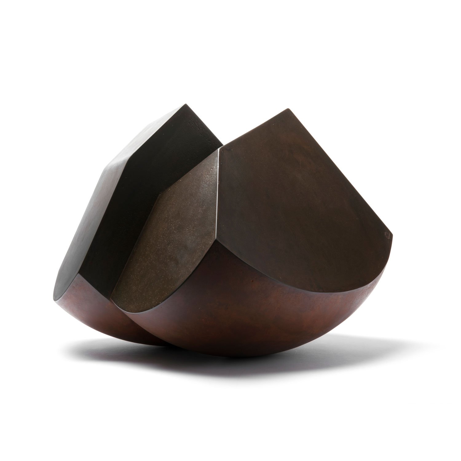
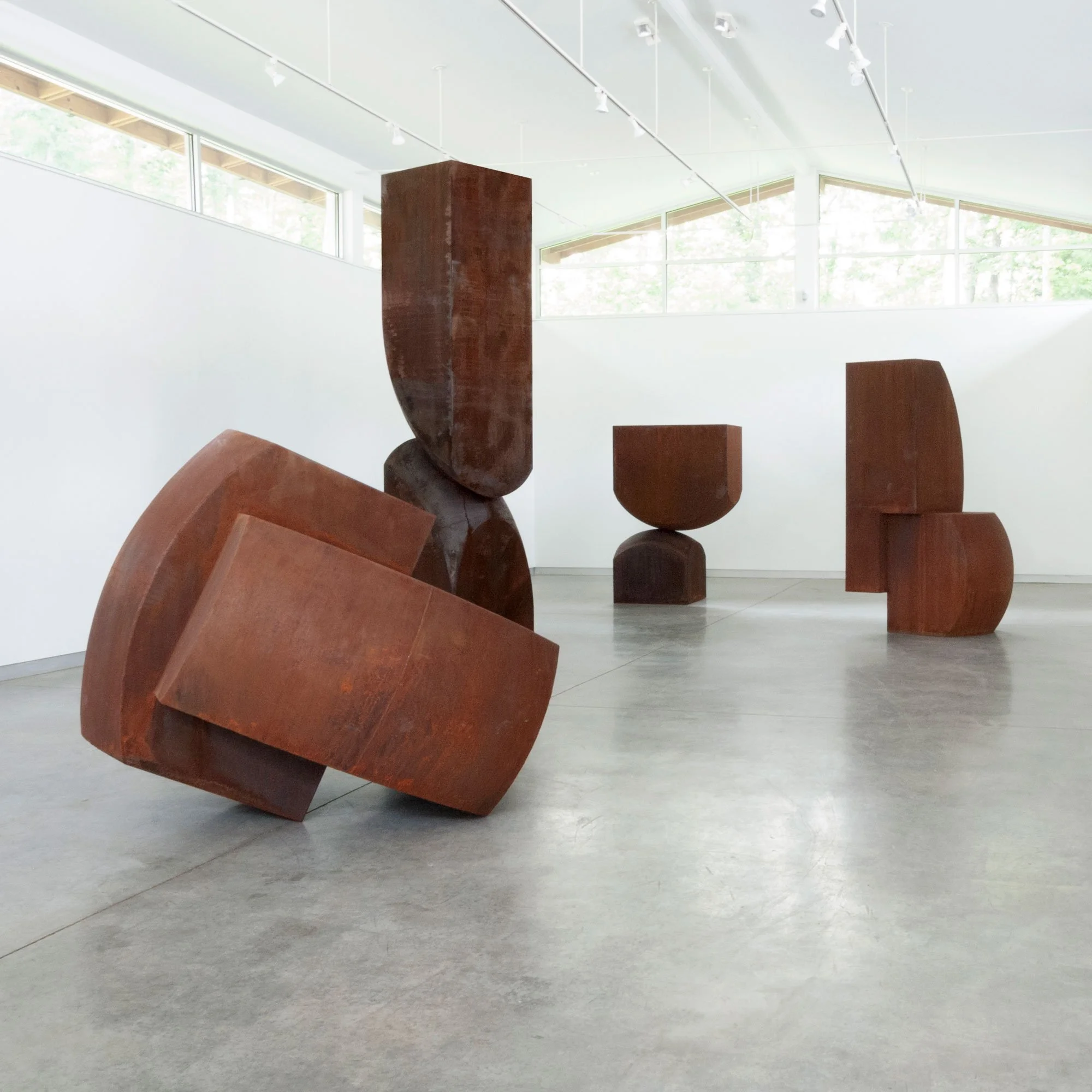
The shapes Haley bends into the For-Ten steel of the works in Correction Line meld these systems together—rectangles taper into rounded points, creating forms that balance or interlock. Instead of lying flat, these forms rise, creating monuments that acknowledge the land development that structured his youth, but also, memorials for a way of life rapidly becoming obsolete. Each sculpture becomes a relic of an existence rusting in the Midwest fields. “Whenever I go back to Kansas,” Haley reflects, “I see the decay — there are fewer. Grain elevators, there are fewer farmsteads, if they are occupied at all there’s a double-wide sitting next to the farm that’s falling in. I’m nostalgic for it and there’s a beauty to that death. These are monuments to that history. There’s a little bit of melancholy in all that.”
A “correction line” represents the moment when rational, abstract thought could not be fully imposed on a form that had natural traits incompatible with the system. But sometimes, reconciling two opposing entities just needs a shift in perspective, and that can be both liberating and dangerous. The same perspective that allowed the land surveys also allowed the disregard for the millions of indigenous people already living on this land. It also enabled a definition of “citizen” that denied those indigenous people, as well as the enslaved people who lived in the country and worked the land.
Jen Sudul Edwards, Ph.D.
Chief Curator/Curator of Contemporary Art, The Mint Museum